Geolocate

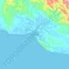
Purari River topographic map

Click on the map to display elevation.

About this map

Name: Purari River topographic map, elevation, terrain.

Location: Purari River, Gulf, Southern Region, Papua New Guinea (-7.83450 144.69420 -6.71424 145.34082)

Average elevation: 308 m

Minimum elevation: -3 m

Maximum elevation: 2,920 m

Other topographic maps

Click on a map to view its topography, its elevation and its terrain.

Kikori

Papua New Guinea > Gulf

Average elevation: 8 m

Pukari

Papua New Guinea > Gulf

Average elevation: 1 m

Baimuru

Papua New Guinea > Gulf

Average elevation: 5 m

Kapuna

Papua New Guinea > Gulf

Average elevation: 5 m

Kerema

Papua New Guinea > Gulf

Average elevation: 77 m

Kerema

Papua New Guinea > Gulf

Average elevation: 77 m

Gear up for your next adventure:

👟Waterproof Leg Gaiters - Keep mud and water out of your boots in boggy terrain
🧰Survival Kits - Emergency tools for remote environments
🔭Compact Hiking Binoculars - Lightweight optics for scouting terrain and spotting wildlife
🧭Emergency Beacons - Safety beacons for remote outdoor locations
👕Merino Base Layers - Natural temperature regulation for cold weather hiking and camping

As an Amazon Associate, this site earns from qualifying purchases at no extra cost to you.