Geolocate

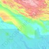
Pukari topographic map

Click on the map to display elevation.

About this map

Name: Pukari topographic map, elevation, terrain.

Location: Pukari, Kerema District, Gulf, Southern Region, Papua New Guinea (-8.07192 145.95000 -8.03192 145.99000)

Average elevation: 1 m

Minimum elevation: -1 m

Maximum elevation: 13 m

Other topographic maps

Click on a map to view its topography, its elevation and its terrain.

Purari River

Papua New Guinea > Gulf

Average elevation: 308 m

Kikori District

Papua New Guinea > Gulf

Average elevation: 441 m

Kikori River

Papua New Guinea > Gulf

Average elevation: 486 m

Gear up for your next adventure:

🥾Women's Waterproof Hiking Boots - High-performance trekking boots designed for all-weather comfort
🔥Reusable Hand Warmers - Maintain dexterity in your fingers for precise map handling
🎿Telescopic Trekking Poles - Reduces knee strain on steep topographic descents
🔭Compact Hiking Binoculars - Lightweight optics for scouting terrain and spotting wildlife
🥾Hiking Boot Waterproofing Wax - Maintain the lifespan of your leather trekking boots

As an Amazon Associate, this site earns from qualifying purchases at no extra cost to you.