Geolocate

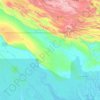
Baimuru topographic map

Click on the map to display elevation.

About this map

Name: Baimuru topographic map, elevation, terrain.

Location: Baimuru, Kikori District, Gulf, Southern Region, Papua New Guinea (-7.53597 144.78847 -7.45597 144.86847)

Average elevation: 5 m

Minimum elevation: -2 m

Maximum elevation: 18 m

Other topographic maps

Click on a map to view its topography, its elevation and its terrain.

Purari River

Papua New Guinea > Gulf

Average elevation: 308 m

Kikori District

Papua New Guinea > Gulf

Average elevation: 441 m

Kikori River

Papua New Guinea > Gulf

Average elevation: 486 m

Gear up for your next adventure:

📷Camera Straps - Secure straps for carrying cameras while walking
⛺Lightweight Solo Tents - Backpacking tents designed for wild camping in the UK highlands
🍱Food Containers - Reusable containers for outdoor meals
🦟Anti-Midge & Tick Repellent - Vital for hiking in the Scottish Highlands during summer
🔦Keychain LED Torches - Emergency backup light for finding gear in your pack

As an Amazon Associate, this site earns from qualifying purchases at no extra cost to you.