Geolocate

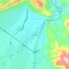
Al Hamriyah topographic map

Click on the map to display elevation.

About this map

Name: Al Hamriyah topographic map, elevation, terrain.

Location: Al Hamriyah, Matrah Province, Muscat Governorate, Oman (23.57404 58.53728 23.58638 58.55027)

Average elevation: 110 m

Minimum elevation: 25 m

Maximum elevation: 287 m

Other topographic maps

Click on a map to view its topography, its elevation and its terrain.

Muscat

Oman > Muscat Governorate

Average elevation: 134 m

Muttrah

Oman > Muscat Governorate

Average elevation: 68 m

Bimmah

Oman > Muscat Governorate > Qurayyat Province

Average elevation: 27 m

Al Amerat

Oman > Muscat Governorate

Average elevation: 178 m

Muscat

Oman > Muscat Governorate

Average elevation: 134 m

Azaibah

Oman > Muscat Governorate > Muscat

Average elevation: 15 m

Yiti

Oman > Muscat Governorate

Average elevation: 92 m

Murrah

Oman > Muscat Governorate

Average elevation: 23 m

Wadi Al Arbeieen

Oman > Muscat Governorate

Average elevation: 846 m

Madinat al Ilam

Oman > Muscat Governorate > Muscat

Average elevation: 32 m

Falaj ash Sham

Oman > Muscat Governorate

Average elevation: 107 m

Falaj

Oman > Muscat Governorate > Muscat

Average elevation: 194 m

Al Hamriyah

Oman > Muscat Governorate > Muscat

Average elevation: 110 m

Mughrah

Oman > Muscat Governorate

Average elevation: 265 m

Al Jazirah

Oman > Muscat Governorate > Muscat

Average elevation: 113 m

Al Khuwayr North

Oman > Muscat Governorate > Muscat

Average elevation: 12 m

Gear up for your next adventure:

👟Waterproof Leg Gaiters - Keep mud and water out of your boots in boggy terrain
🧦Hiking Socks - Breathable socks designed to prevent blisters on long walks
🧢Hiking Hats - Sun and weather protection for outdoor walks
🥤Hiking Water Bottles - Reusable bottles for hydration on the trail
🌄Outdoor Binoculars - Compact binoculars for landscape observation

As an Amazon Associate, this site earns from qualifying purchases at no extra cost to you.