Geolocate

Ota topographic map

Click on the map to display elevation.

About this map

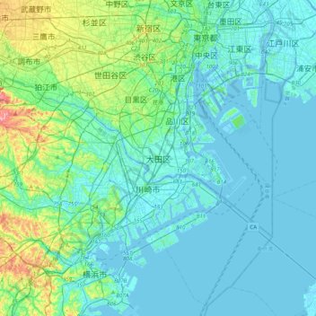
Name: Ota topographic map, elevation, terrain.

Location: Ota, Tokyo, 144-8621, Japan (35.40121 139.55584 35.72121 139.87584)

Average elevation: 18 m

Minimum elevation: -7 m

Maximum elevation: 118 m

Other topographic maps

Click on a map to view its topography, its elevation and its terrain.

Kamata

Japan > Ota

Average elevation: 7 m

Gear up for your next adventure:

🖼️Topographic Map Art - Decorative 3D-effect posters of famous UK peaks and regions
🎒Hiking Daypacks (20L) - Compact backpacks for day trips and technical mountain ascents
🧊Insulated Flasks - Keeps drinks hot or cold during hikes
🔦Outdoor Torches - Reliable torches for night navigation
🦟Anti-Midge & Tick Repellent - Vital for hiking in the Scottish Highlands during summer

As an Amazon Associate, this site earns from qualifying purchases at no extra cost to you.