
Buliisa topographic map
Interactive map
Click on the map to display elevation.
About this map
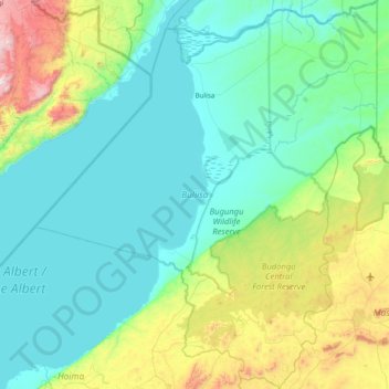
Name: Buliisa topographic map, elevation, terrain.
Location: Buliisa, Western Region, Uganda (1.54072 31.07670 2.30416 31.75000)
Average elevation: 833 m
Minimum elevation: 607 m
Maximum elevation: 1,846 m
Other topographic maps
Click on a map to view its topography, its elevation and its terrain.