
Chester topographic map
Interactive map
Click on the map to display elevation.
About this map
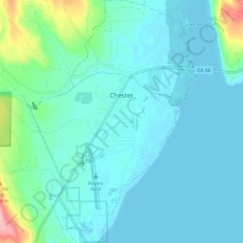
Name: Chester topographic map, elevation, terrain.
Location: Chester, Plumas County, Californie, États-Unis d'Amérique (40.26658 -121.26345 40.33103 -121.20522)
Average elevation: 1,391 m
Minimum elevation: 1,367 m
Maximum elevation: 1,533 m
Other topographic maps
Click on a map to view its topography, its elevation and its terrain.
East Quincy
États-Unis d'Amérique > Californie > Plumas County
East Quincy, Plumas County, Californie, 95971, États-Unis d'Amérique
Average elevation: 1,119 m