
Ronel topographic map
Interactive map
Click on the map to display elevation.
About this map
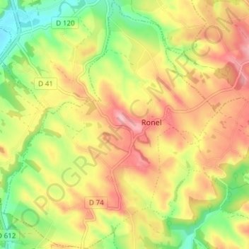
Name: Ronel topographic map, elevation, terrain.
Average elevation: 290 m
Minimum elevation: 212 m
Maximum elevation: 361 m
L'altitude de la commune varie entre 235 et 370 mètres.
Other topographic maps
Click on a map to view its topography, its elevation and its terrain.
Le Trivalou
France > Occitanie > Tarn > Terre-de-Bancalié > Le Trivalou
Le Trivalou, Terre-Clapier, Terre-de-Bancalié, Albi, Tarn, Occitanie, France métropolitaine, 81120, France
Average elevation: 368 m
Saint-Lieux-Lafenasse
France > Occitanie > Tarn > Terre-de-Bancalié
Saint-Lieux-Lafenasse, Terre-de-Bancalié, Albi, Tarn, Occitanie, France métropolitaine, 81120, France
Average elevation: 292 m