
空山镇 topographic map
Interactive map
Click on the map to display elevation.
About this map
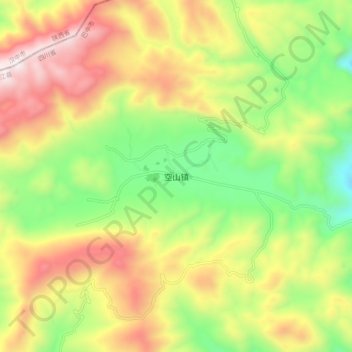
Name: 空山镇 topographic map, elevation, terrain.
Location: 空山镇, 通江县, 巴中市, 四川省, 中国 (32.44056 107.32974 32.52056 107.40974)
Average elevation: 1,432 m
Minimum elevation: 901 m
Maximum elevation: 2,063 m
Other topographic maps
Click on a map to view its topography, its elevation and its terrain.