
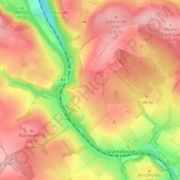
Penmanshiel topographic map
Interactive map
Click on the map to display elevation.
About this map
Name: Penmanshiel topographic map, elevation, terrain.
Average elevation: 179 m
Minimum elevation: 73 m
Maximum elevation: 244 m
Scottish Borders trails, hiking, mountain biking, running and outdoor activities
Other topographic maps
Click on a map to view its topography, its elevation and its terrain.
Greenknowe Tower
United Kingdom > Scotland > Scottish Borders > Gordon > Nether Huntlywood
Average elevation: 157 m
Curling Pond
United Kingdom > Scotland > Scottish Borders > Earlston > Georgefield
Average elevation: 153 m