
Thank you for supporting this site ❤️
Make a donation
Make a donation
Gear up for your next adventure:
As an Amazon Associate, this site earns from qualifying purchases at no extra cost to you.
Kengu topographic map
Click on the map to display elevation.
Thank you for supporting this site ❤️
Make a donation
Make a donation
Gear up for your next adventure:
As an Amazon Associate, this site earns from qualifying purchases at no extra cost to you.
About this map
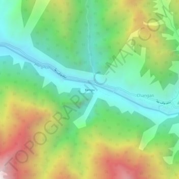
Name: Kengu topographic map, elevation, terrain.
Location: Kengu, Changan, Neelam Valley District, Azad Kashmir, Pakistan (34.70072 74.02744 34.74072 74.06744)
Average elevation: 2,325 m
Minimum elevation: 1,638 m
Maximum elevation: 3,543 m
Thank you for supporting this site ❤️
Make a donation
Make a donation
Gear up for your next adventure:
As an Amazon Associate, this site earns from qualifying purchases at no extra cost to you.