

Azad Kashmir topographic maps
Click on a map to view its topography, its elevation and its terrain.


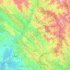
Rawalakot
Pakistan > Azad Kashmir > Poonch District
Rawalakot is located at Latitude 33°51'32.18"N, Longitude 73° 45'34.93"E and an Elevation of 5374 feet. Rawalakot is approximately 76 kilometres (47 mi) from Kahuta and about 120 km (75 mi) from the city of Rawalpindi, Pakistan. It is linked with Rawalpindi and Islamabad via Goyain Nala and Tain roads. Via…
Average elevation: 1,501 m

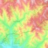
Khuiratta Tehsil
Pakistan > Azad Kashmir > Kotli District
Khuiratta lies 29 km southeast of Kotli and 154 km from Islamabad, to the east. Khuiratta is approximately 7 kilometres from the Line of Control (LOC). It is the second largest town of District Kotli after Kotli City. It has an elevation of 2570 feet above sea-level. Khuiratta is situated on the western side…
Average elevation: 914 m










Amgah Paanch Peer
Pakistan > Azad Kashmir > Bhimber District > Barnala Tehsil
Average elevation: 535 m

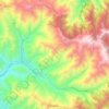
Mirpur
Pakistan > Azad Kashmir > Mirpur District
Mirpur lies at the foothills of the Himalayas mountain range of an altitude of 648 metres or 2,126 feet above sea level and is linked with the main Peshawar-Lahore Grand Trunk Road at Dina Tehsil in Jhelum District. It is the headquarters of Mirpur District, which has two subdivisions: Mirpur and Dudial.
Average elevation: 377 m


