Geolocate

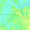
Bolton topographic map

Click on the map to display elevation.

About this map

Name: Bolton topographic map, elevation, terrain.

Location: Bolton, Columbus County, North Carolina, United States (34.30567 -78.42290 34.32849 -78.36339)

Average elevation: 18 m

Minimum elevation: 10 m

Maximum elevation: 23 m

Other topographic maps

Click on a map to view its topography, its elevation and its terrain.

Delco

United States > North Carolina > Columbus County

Average elevation: 11 m

Gear up for your next adventure:

🦶Anti-Blister Balms - Protect your feet before long topographic expeditions
🧊Insulated Flasks - Keeps drinks hot or cold during hikes
🥤Hiking Water Bottles - Reusable bottles for hydration on the trail
⛺Lightweight Tents - Compact tents for backpacking and trekking
🧼Camping Hygiene Kits - Compact hygiene essentials for outdoor stays

As an Amazon Associate, this site earns from qualifying purchases at no extra cost to you.