Geolocate

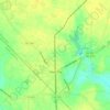
Riverview topographic map

Click on the map to display elevation.

About this map

Name: Riverview topographic map, elevation, terrain.

Location: Riverview, Columbus County, North Carolina, United States (34.16767 -78.57807 34.20767 -78.53807)

Average elevation: 13 m

Minimum elevation: 9 m

Maximum elevation: 16 m

Other topographic maps

Click on a map to view its topography, its elevation and its terrain.
Bolton

United States > North Carolina > Columbus County

Average elevation: 18 m

Gear up for your next adventure:

🧤Hiking Gloves - Warm and durable gloves for cold-weather walks
🧘Folding Sit Mats - Dry and warm seat for map-reading breaks on damp ground
🎒Hiking Child Carriers - Explore the outdoors with the whole family safely
🛰️Handheld GPS Devices - Reliable GPS units for hiking and outdoor navigation
🧭Professional Hiking Compasses - High-precision liquid-filled compasses for map reading and orientation

As an Amazon Associate, this site earns from qualifying purchases at no extra cost to you.