
Town of Middleburgh topographic map
Interactive map
Click on the map to display elevation.
About this map
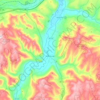
Name: Town of Middleburgh topographic map, elevation, terrain.
Average elevation: 406 m
Minimum elevation: 174 m
Maximum elevation: 707 m
Other topographic maps
Click on a map to view its topography, its elevation and its terrain.
Town of Gilboa
United States > New York > Schoharie County
Town of Gilboa, Schoharie County, New York, United States
Average elevation: 541 m
Watsonville
United States > New York > Schoharie County > Watsonville
Watsonville, Town of Fulton, Schoharie County, New York, 12071, United States
Average elevation: 339 m
Petersburg Mountain
United States > New York > Schoharie County
Petersburg Mountain, Town of Fulton, Schoharie County, New York, 12187, United States
Average elevation: 604 m
Village of Cobleskill
United States > New York > Schoharie County > Town of Cobleskill
Village of Cobleskill, Town of Cobleskill, Schoharie County, New York, United States
Average elevation: 345 m