
Благодатное topographic map
Interactive map
Click on the map to display elevation.
About this map
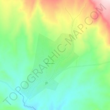
Name: Благодатное topographic map, elevation, terrain.
Location: Благодатное, Urzhar District, Abay Region, Kazakhstan (47.22525 81.38897 47.26525 81.42897)
Average elevation: 879 m
Minimum elevation: 742 m
Maximum elevation: 1,124 m
Other topographic maps
Click on a map to view its topography, its elevation and its terrain.
Тасарық
Kazakhstan > Abay Region > Urzhar District
Тасарық, Urzhar District, Abay Region, Kazakhstan
Average elevation: 532 m
Tarbagatai Mountains
Kazakhstan > Abay Region > Urzhar District
Tarbagatai Mountains, Urzhar District, Abay Region, Kazakhstan
Average elevation: 2,750 m