
Yebyu Township topographic map
Interactive map
Click on the map to display elevation.
About this map
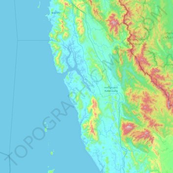
Name: Yebyu Township topographic map, elevation, terrain.
Location: Yebyu Township, Dawei District, Tanintharyi Region, Myanmar (14.16848 97.56829 15.10368 98.43916)
Average elevation: 164 m
Minimum elevation: -1 m
Maximum elevation: 1,361 m
Other topographic maps
Click on a map to view its topography, its elevation and its terrain.
Kanbauk
Myanmar > Tanintharyi Region > Yebyu Township
Kanbauk, Yebyu Township, Dawei District, Tanintharyi Region, Myanmar
Average elevation: 81 m