
Borgata Re topographic map
Interactive map
Click on the map to display elevation.
About this map
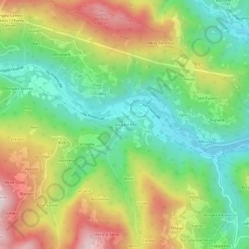
Name: Borgata Re topographic map, elevation, terrain.
Location: Borgata Re, Melle, Coni, Piémont, Italie (44.54017 7.29787 44.58017 7.33787)
Average elevation: 920 m
Minimum elevation: 621 m
Maximum elevation: 1,362 m
Other topographic maps
Click on a map to view its topography, its elevation and its terrain.