
Shell topographic map
Click on the map to display elevation.
About this map
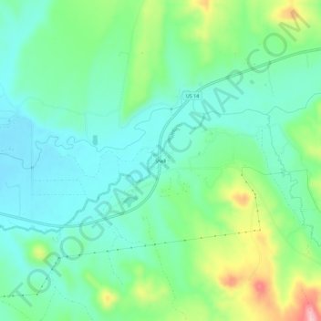
Name: Shell topographic map, elevation, terrain.
Location: Shell, Big Horn County, Wyoming, 82441, United States (44.51552 -107.79981 44.55552 -107.75981)
Average elevation: 1,317 m
Minimum elevation: 1,265 m
Maximum elevation: 1,449 m
Other topographic maps
Click on a map to view its topography, its elevation and its terrain.