
Nurak topographic map
Interactive map
Click on the map to display elevation.
About this map
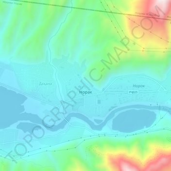
Name: Nurak topographic map, elevation, terrain.
Location: Nurak, Norak District, Khatlon Region, Tajikistan (38.38331 69.29767 38.39908 69.35011)
Average elevation: 780 m
Minimum elevation: 625 m
Maximum elevation: 1,321 m
Other topographic maps
Click on a map to view its topography, its elevation and its terrain.