
Қарамұрт topographic map
Interactive map
Click on the map to display elevation.
About this map
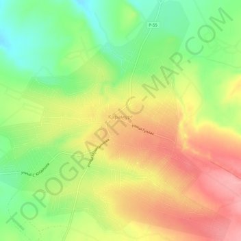
Name: Қарамұрт topographic map, elevation, terrain.
Location: Қарамұрт, Sayram District, Turkistan Region, Kazakhstan (42.29292 69.94573 42.33048 69.99631)
Average elevation: 888 m
Minimum elevation: 829 m
Maximum elevation: 946 m
Other topographic maps
Click on a map to view its topography, its elevation and its terrain.