
La Mela topographic map
Interactive map
Click on the map to display elevation.
About this map
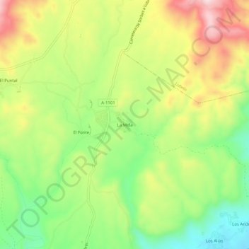
Name: La Mela topographic map, elevation, terrain.
Location: La Mela, Sorbas, Alméria, Andalousie, Espagne (37.14426 -2.12677 37.18426 -2.08677)
Average elevation: 555 m
Minimum elevation: 394 m
Maximum elevation: 749 m
Other topographic maps
Click on a map to view its topography, its elevation and its terrain.
Gafares
Espagne > Andalousie > Sorbas > Gafares
Gafares, Sorbas, Alméria, Andalousie, Espagne
Average elevation: 279 m