
Town of Dunn topographic map
Interactive map
Click on the map to display elevation.
About this map
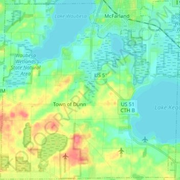
Name: Town of Dunn topographic map, elevation, terrain.
Location: Town of Dunn, Dane County, Wisconsin, United States (42.93142 -89.36875 43.01997 -89.24713)
Average elevation: 273 m
Minimum elevation: 255 m
Maximum elevation: 317 m
Other topographic maps
Click on a map to view its topography, its elevation and its terrain.
Isthmus Path Prairie Garden
United States > Wisconsin > Dane County > Madison
Average elevation: 262 m