
Al Qabil topographic map
Interactive map
Click on the map to display elevation.
About this map
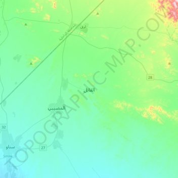
Name: Al Qabil topographic map, elevation, terrain.
Location: Al Qabil, Ash Sharqiyah North, Oman (22.44345 58.02369 22.76345 58.34369)
Average elevation: 445 m
Minimum elevation: 328 m
Maximum elevation: 1,024 m
Other topographic maps
Click on a map to view its topography, its elevation and its terrain.
Maqtaah
Oman > Ash Sharqiyah North > Maqtaah
Maqtaah, Ash Sharqiyah North, Oman
Average elevation: 1,217 m
Al Ghabbi
Al Ghabbi, Ash Sharqiyah North, 421, Oman
Average elevation: 299 m
Al Wasil
Oman > Ash Sharqiyah North > Al Wasil
Al Wasil, Ash Sharqiyah North, Oman
Average elevation: 318 m