
Al Ghabbi topographic map
Interactive map
Click on the map to display elevation.
About this map
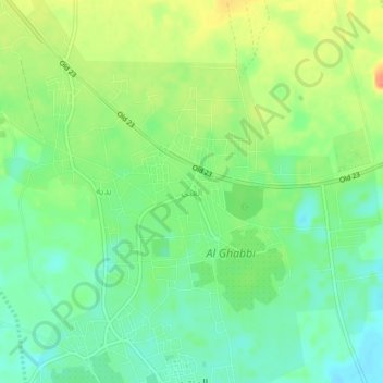
Name: Al Ghabbi topographic map, elevation, terrain.
Location: Al Ghabbi, Ash Sharqiyah North, 421, Oman (22.42991 58.79022 22.46991 58.83022)
Average elevation: 299 m
Minimum elevation: 279 m
Maximum elevation: 327 m
Other topographic maps
Click on a map to view its topography, its elevation and its terrain.
Maqtaah
Oman > Ash Sharqiyah North > Maqtaah
Maqtaah, Ash Sharqiyah North, Oman
Average elevation: 1,217 m
Al Wasil
Oman > Ash Sharqiyah North > Al Wasil
Al Wasil, Ash Sharqiyah North, Oman
Average elevation: 318 m