Geolocate

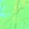
Rybakivka topographic map

Click on the map to display elevation.

About this map
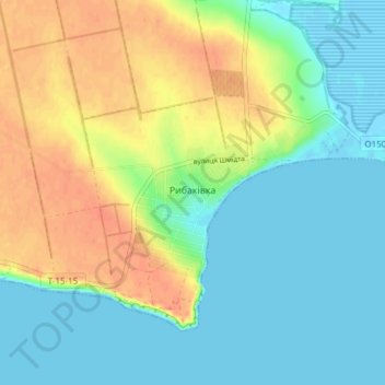
Name: Rybakivka topographic map, elevation, terrain.

Location: Rybakivka, Коблівська сільська громада, Mykolaiv Raion, Mykolaiv Oblast, 57462, Ukraine (46.60755 31.33882 46.63073 31.41474)

Average elevation: 16 m

Minimum elevation: -3 m

Maximum elevation: 41 m

Other topographic maps

Click on a map to view its topography, its elevation and its terrain.

Kavkaz

Ukraine > Mykolaiv Oblast

Average elevation: 67 m

Poltavka

Ukraine > Mykolaiv Oblast

Average elevation: 92 m

Znamianka

Ukraine > Mykolaiv Oblast

Average elevation: 48 m

Hlyboke

Ukraine > Mykolaiv Oblast

Average elevation: 39 m

Sukha Balka

Ukraine > Mykolaiv Oblast

Average elevation: 116 m

Pivni

Ukraine > Mykolaiv Oblast

Average elevation: 94 m

Poltavka

Ukraine > Mykolaiv Oblast

Average elevation: 92 m

Sukha Balka

Ukraine > Mykolaiv Oblast

Average elevation: 116 m

Gear up for your next adventure:

🔥Emergency Fire Starters - Reliable ignition tools for survival situations in damp conditions
🧦Hiking Socks - Breathable socks designed to prevent blisters on long walks
👟Women's Trail Running Shoes - Agile footwear for fell running and technical trails
🥾Hiking Boots - Waterproof and durable boots for long-distance hiking in the UK
🖼️Topographic Map Art - Decorative 3D-effect posters of famous UK peaks and regions

As an Amazon Associate, this site earns from qualifying purchases at no extra cost to you.