
Lake Melville topographic map
Interactive map
Click on the map to display elevation.
About this map
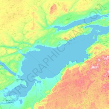
Name: Lake Melville topographic map, elevation, terrain.
Location: Lake Melville, Labrador, Newfoundland and Labrador, Canada (53.41252 -60.13943 54.09500 -58.32975)
Average elevation: 238 m
Minimum elevation: -3 m
Maximum elevation: 1,126 m
Other topographic maps
Click on a map to view its topography, its elevation and its terrain.
Pee Pee Island
Canada > Newfoundland and Labrador > unincorporated Newfoundland
Average elevation: 16 m
Fogo Island
Canada > Newfoundland and Labrador > Joe Batt's Arm-Barr'd Islands-Shoal Bay
Average elevation: 3 m