
Netstal topographic map
Interactive map
Click on the map to display elevation.
About this map
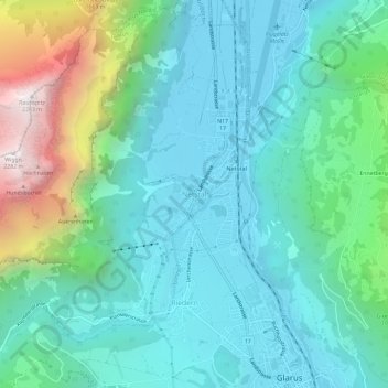
Name: Netstal topographic map, elevation, terrain.
Location: Netstal, Glarus, 8754, Schweiz (47.04113 9.03297 47.08113 9.07297)
Average elevation: 850 m
Minimum elevation: 443 m
Maximum elevation: 2,269 m
Other topographic maps
Click on a map to view its topography, its elevation and its terrain.