
Town of Pleasant Springs topographic map
Interactive map
Click on the map to display elevation.
About this map
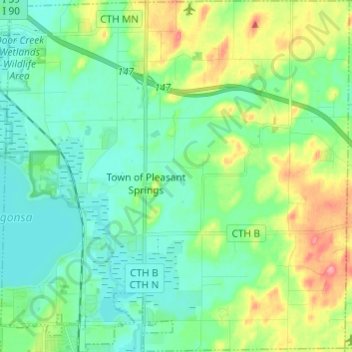
Name: Town of Pleasant Springs topographic map, elevation, terrain.
Average elevation: 277 m
Minimum elevation: 253 m
Maximum elevation: 337 m
Other topographic maps
Click on a map to view its topography, its elevation and its terrain.
Isthmus Path Prairie Garden
United States > Wisconsin > Dane County > Madison
Average elevation: 262 m