
Rutland City topographic map
Interactive map
Click on the map to display elevation.
About this map
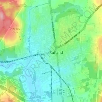
Name: Rutland City topographic map, elevation, terrain.
Location: Rutland City, Rutland County, Vermont, 05702, United States (43.58673 -73.01145 43.63127 -72.94558)
Average elevation: 200 m
Minimum elevation: 156 m
Maximum elevation: 295 m
Other topographic maps
Click on a map to view its topography, its elevation and its terrain.
Billings Mobile Manor
United States > Vermont > Rutland County > Rutland City
Average elevation: 211 m
West Tinmouth
United States > Vermont > Rutland County > Tinmouth > West Tinmouth
Average elevation: 419 m