Geolocate

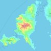
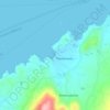
Tsoukalia topographic map

Click on the map to display elevation.

About this map

Name: Tsoukalia topographic map, elevation, terrain.

Location: Tsoukalia, Paros Municipality, Paros Regional Unit, South Aegean, Aegean, 844 00, Greece (37.04874 25.24026 37.08874 25.28026)

Average elevation: 18 m

Minimum elevation: 0 m

Maximum elevation: 166 m

Other topographic maps

Click on a map to view its topography, its elevation and its terrain.
Paros

Greece > Aegean > Paros Regional Unit

Average elevation: 69 m

Paros

Greece > Aegean > Paros Regional Unit

Average elevation: 69 m

Antiparos

Greece > Aegean > Paros Regional Unit > Antiparos

Average elevation: 20 m

Paros

Greece > Aegean > Paros Regional Unit

Average elevation: 69 m

Paros

Greece > Aegean > Paros Regional Unit

Average elevation: 69 m

Gear up for your next adventure:

🧤Thermal Touchscreen Gloves - Stay warm while operating your GPS or smartphone camera
🔦Keychain LED Torches - Emergency backup light for finding gear in your pack
⌚GPS Outdoor Watches - Watches with GPS tracking for hiking and exploration
👖Packable Overtrousers - Quick-deploy rain protection for legs in sudden storms
🎒Hiking Backpacks - Comfortable backpacks for day hikes and multi-day treks

As an Amazon Associate, this site earns from qualifying purchases at no extra cost to you.