
Gençlik Parkı topographic map
Interactive map
Click on the map to display elevation.
Gençlik Parkı
The 27.5 ha (68 acres) park is almost at the center of Ankara. Its altitude is about 850 m (2,790 ft), which makes it one of the lowest points in Ankara. It is surrounded by Ulus Square to the north, the Ankara Opera House (formerly Ankara Exhibition Building) to the east, Selim Sırrı Tarcan Sport Hall and Ankara Central Station to the south and, 19 Mayıs Stadium to the west.
About this map
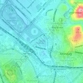
Name: Gençlik Parkı topographic map, elevation, terrain.
Average elevation: 870 m
Minimum elevation: 842 m
Maximum elevation: 1,000 m
Other topographic maps
Click on a map to view its topography, its elevation and its terrain.