
史灌河 topographic map
Interactive map
Click on the map to display elevation.
About this map
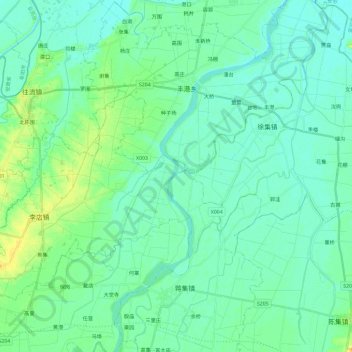
Name: 史灌河 topographic map, elevation, terrain.
Location: 史灌河, 固始县, 信阳市, 河南省, 中国 (32.26665 115.72494 32.46369 115.83956)
Average elevation: 33 m
Minimum elevation: 22 m
Maximum elevation: 72 m
Other topographic maps
Click on a map to view its topography, its elevation and its terrain.