Geolocate

Casterton topographic map

Click on the map to display elevation.

About this map

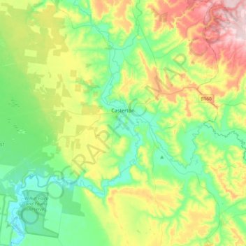
Name: Casterton topographic map, elevation, terrain.

Location: Casterton, Shire of Glenelg, Victoria, 3311, Australia (-37.67568 141.15112 -37.52487 141.51783)

Average elevation: 118 m

Minimum elevation: 23 m

Maximum elevation: 317 m

Gear up for your next adventure:

📚UK Hiking Guidebooks - Detailed route descriptions for the Lake District, Peaks, and Highlands
🧢Thermal Beanie Hats - Prevent heat loss from the head in windy summit conditions
🎒Hiking Backpacks - Comfortable backpacks for day hikes and multi-day treks
📱Rugged Phone Cases - Heavy-duty protection for smartphones used as secondary GPS tools
📦Dry Bags - Waterproof bags to protect gear from rain

As an Amazon Associate, this site earns from qualifying purchases at no extra cost to you.