
西鄉村 topographic map
Interactive map
Click on the map to display elevation.
About this map
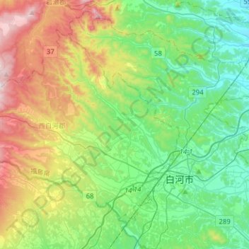
Name: 西鄉村 topographic map, elevation, terrain.
Location: 西鄉村, 西白河郡, 福岛县, 日本 (37.09229 139.95892 37.24660 140.21073)
Average elevation: 498 m
Minimum elevation: 269 m
Maximum elevation: 1,006 m
Other topographic maps
Click on a map to view its topography, its elevation and its terrain.