
Colțu Cornii topographic map
Interactive map
Click on the map to display elevation.
About this map
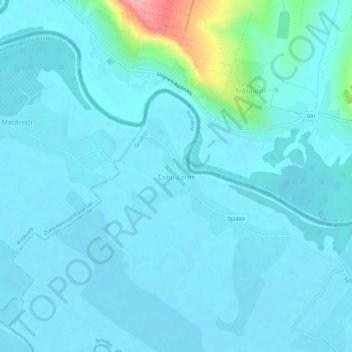
Name: Colțu Cornii topographic map, elevation, terrain.
Location: Colțu Cornii, Grozești, Iași, 707236, Romania (47.00843 27.97246 47.04843 28.01246)
Average elevation: 38 m
Minimum elevation: 26 m
Maximum elevation: 139 m
Other topographic maps
Click on a map to view its topography, its elevation and its terrain.