Geolocate

Goba topographic map

Click on the map to display elevation.

Goba

Goba (Oromo: Gobbaa, Amharic: ጎባ) is a town and separate woreda located in the Bale Zone of the Oromia Region, Ethiopia approximately 446 km southeast of Addis Ababa, this city has a latitude and longitude of 7°0′N 39°59′E / 7.000°N 39.983°E / 7.000; 39.983 and an elevation of 2,743 meters above sea level.

Wikipedia (CC-BY-SA 3.0)

About this map

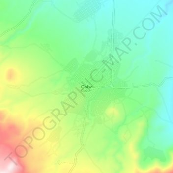
Name: Goba topographic map, elevation, terrain.

Location: Goba, Bale, Oromia Region, Ethiopia (6.96733 39.92942 7.04733 40.00942)

Average elevation: 2,736 m

Minimum elevation: 2,536 m

Maximum elevation: 3,175 m

Other topographic maps

Click on a map to view its topography, its elevation and its terrain.

Bale Mountains National Park

Ethiopia > Oromia Region

The Bale Mountains play a vital role in climate control of the region by attracting large amounts of orographic rainfall, which has obvious implications for livestock and agricultural production. Some 600–1,000 mm (24–39 in) fall annually in the lower altitude areas, while 1,000–1,400 mm (39–55 in)…

Average elevation: 2,612 m

Ejere

Ethiopia > Oromia Region

Average elevation: 2,408 m

Asela

Ethiopia > Oromia Region

Asella (Oromo: Asallaa, Amharic: አሰላ) is a town in central Ethiopia. Located in the Arsi Zone of the Oromia Region 126 km (78 mi) south from Addis Ababa, this town has a latitude and longitude of 7°57′N 39°7′E / 7.950°N 39.117°E / 7.950; 39.117, with an elevation of 2,430 meters. Asella…

Average elevation: 2,429 m

Arsi

Ethiopia > Oromia Region

Average elevation: 2,011 m

Muger

Ethiopia > Oromia Region > Abuna Ginde Beret

Average elevation: 1,676 m

Awash River

Ethiopia > Oromia Region > Sodere

Average elevation: 1,388 m

Lake Langano

Ethiopia > Oromia Region

Lake Langano (Oromo: Hora Langaanoo, Amharic: ላንጋኖ ሐይቅ) is a lake in the Oromia Region of Ethiopia, exactly 200 kilometers by road south of the capital, Addis Ababa, on the border between the East Shewa Zone and Arsi Zones. It is located to the east of Lake Abijatta in the Main Ethiopian Rift at…

Average elevation: 1,625 m

Adama

Ethiopia > Oromia Region

Average elevation: 1,676 m

Hulul

Ethiopia > Oromia Region

Average elevation: 1,760 m

West Shewa

Ethiopia > Oromia Region

Average elevation: 2,128 m

Dukem

Ethiopia > Oromia Region

Average elevation: 1,809 m

Bale

Ethiopia > Oromia Region

Average elevation: 1,281 m

Gear up for your next adventure:

🕶️Glacier Goggles - Maximum protection for high-altitude snow topography
📱Rugged Phone Cases - Heavy-duty protection for smartphones used as secondary GPS tools
GPS Outdoor Watches - Watches with GPS tracking for hiking and exploration
🔦Waterproof LED Headlamps - Hands-free lighting for evening treks and emergency navigation
🧺Mesh Stuff Sacks - Breathable storage for wet gear or camp organization

As an Amazon Associate, this site earns from qualifying purchases at no extra cost to you.