Geolocate

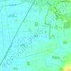
Wymott topographic map

Click on the map to display elevation.

About this map

Name: Wymott topographic map, elevation, terrain.

Location: Wymott, Ulnes Walton, Chorley, Lancashire, England, PR26 8NH, United Kingdom (53.66088 -2.76627 53.70088 -2.72627)

Average elevation: 17 m

Minimum elevation: 5 m

Maximum elevation: 31 m

Lancashire trails, hiking, mountain biking, running and outdoor activities

Other topographic maps

Click on a map to view its topography, its elevation and its terrain.

Heapey

United Kingdom > England > Lancashire > Chorley > Wheelton

Average elevation: 127 m

Heskin

United Kingdom > England > Lancashire > Chorley

Average elevation: 56 m

Rivington

United Kingdom > England > Lancashire > Chorley > Rivington

Average elevation: 244 m

Croston

United Kingdom > England > Lancashire > Chorley

Average elevation: 8 m

Bretherton

United Kingdom > England > Lancashire > Chorley

Average elevation: 10 m

Wheelton

United Kingdom > England > Lancashire > Chorley > Brinscall

Average elevation: 183 m

Coppull

United Kingdom > England > Lancashire > Chorley

The settlement has an Anglo Saxon name describing its topography derived from the Old English copp a hill top and hyll a hill. The township was variously recorded as Cophull and Cophulle in 1277, Copphull in 1351, Copthull in 1374 and Coppull from 1444.

Average elevation: 82 m

Clayton-le-Woods

United Kingdom > England > Lancashire > Chorley

Average elevation: 72 m

Brindle

United Kingdom > England > Lancashire > Chorley > Brindle

Average elevation: 114 m

Euxton

United Kingdom > England > Lancashire > Chorley

Average elevation: 50 m

Whittle-le-Woods

United Kingdom > England > Lancashire > Chorley

Average elevation: 88 m

Charnock Richard

United Kingdom > England > Lancashire > Chorley

Average elevation: 70 m

Adlington

United Kingdom > England > Lancashire > Chorley > Adlington

Average elevation: 95 m

Moss Wood

United Kingdom > England > Lancashire > Chorley

Average elevation: 8 m

Withnell

United Kingdom > England > Lancashire > Chorley > Abbey Village

Average elevation: 204 m

River Darwen

United Kingdom > England > Lancashire > Chorley

Average elevation: 123 m

Hoghton

United Kingdom > England > Lancashire > Chorley > Hoghton

Average elevation: 104 m

Bretherton

United Kingdom > England > Lancashire > Chorley > Bretherton

Average elevation: 10 m

Coppull

United Kingdom > England > Lancashire > Chorley

The settlement has an Anglo Saxon name describing its topography derived from the Old English copp a hill top and hyll a hill. The township was variously recorded as Cophull and Cophulle in 1277, Copphull in 1351, Copthull in 1374 and Coppull from 1444.

Average elevation: 80 m

Gear up for your next adventure:

🧴Tick Removal Tools - Small, essential health tool for UK woodland and moorland
🪢Paracord - Multi-purpose cord for camping and survival
🥾Men's Waterproof Hiking Boots - Durable footwear with deep lugs for muddy and rocky UK terrains
🥾Women's Waterproof Hiking Boots - High-performance trekking boots designed for all-weather comfort
🔋Power Banks - Portable chargers for long outdoor trips

As an Amazon Associate, this site earns from qualifying purchases at no extra cost to you.