Geolocate

Madison topographic map

Click on the map to display elevation.

About this map
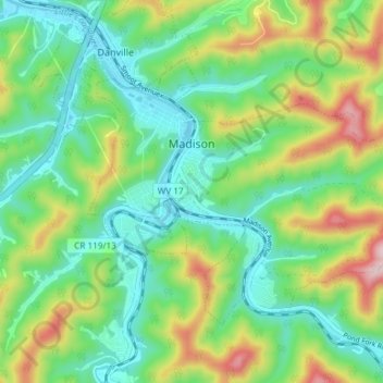
Name: Madison topographic map, elevation, terrain.

Location: Madison, Boone County, West Virginia, 25130, United States (38.03999 -81.83798 38.08387 -81.74906)

Average elevation: 332 m

Minimum elevation: 202 m

Maximum elevation: 586 m

Other topographic maps

Click on a map to view its topography, its elevation and its terrain.

Lory

United States > West Virginia > Boone County

Average elevation: 313 m

Seth

United States > West Virginia > Boone County

Average elevation: 339 m

Andrew

United States > West Virginia > Boone County

Average elevation: 394 m

Bob White

United States > West Virginia > Boone County

Average elevation: 410 m

Gear up for your next adventure:

🥤Hiking Water Bottles - Reusable bottles for hydration on the trail
🚶Walking Pedometers - Simple distance tracking for casual trail walkers
🎿Telescopic Trekking Poles - Reduces knee strain on steep topographic descents
⛺Lightweight Solo Tents - Backpacking tents designed for wild camping in the UK highlands
🍲Portable Camping Stoves - Fast-boiling stoves for hot meals on remote topographic survey trips

As an Amazon Associate, this site earns from qualifying purchases at no extra cost to you.