Geolocate

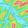
Seth topographic map

Click on the map to display elevation.

About this map

Name: Seth topographic map, elevation, terrain.

Location: Seth, Boone County, West Virginia, 25049, United States (38.08816 -81.64317 38.12816 -81.60317)

Average elevation: 339 m

Minimum elevation: 202 m

Maximum elevation: 486 m

Other topographic maps

Click on a map to view its topography, its elevation and its terrain.

Madison

United States > West Virginia > Boone County

Average elevation: 332 m

Danville

United States > West Virginia > Boone County

Average elevation: 280 m

Gear up for your next adventure:

🎿Telescopic Trekking Poles - Reduces knee strain on steep topographic descents
🧴Tick Removal Tools - Small, essential health tool for UK woodland and moorland
🗺️Ordnance Survey Maps - Essential paper maps for hiking across the UK national parks
🍲Portable Camping Stoves - Fast-boiling stoves for hot meals on remote topographic survey trips
🦟Anti-Midge & Tick Repellent - Vital for hiking in the Scottish Highlands during summer

As an Amazon Associate, this site earns from qualifying purchases at no extra cost to you.