
Kibeho topographic map
Interactive map
Click on the map to display elevation.
About this map
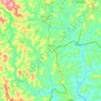
Name: Kibeho topographic map, elevation, terrain.
Location: Kibeho, Nyaruguru District, Southern Province, Rwanda (-2.70497 29.51235 -2.59875 29.62297)
Average elevation: 1,876 m
Minimum elevation: 1,746 m
Maximum elevation: 2,158 m
Other topographic maps
Click on a map to view its topography, its elevation and its terrain.