
Beşpınar Mahallesi topographic map
Interactive map
Click on the map to display elevation.
About this map
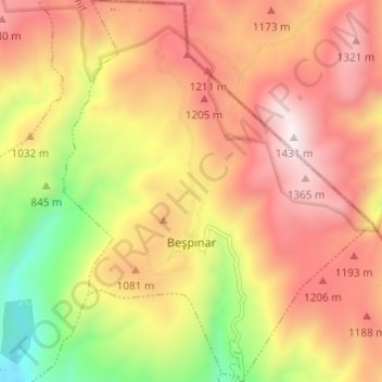
Name: Beşpınar Mahallesi topographic map, elevation, terrain.
Location: Beşpınar Mahallesi, Kemalpaşa, Izmir, Aegean Region, Turkey (38.50184 27.43178 38.54950 27.48110)
Average elevation: 1,004 m
Minimum elevation: 436 m
Maximum elevation: 1,441 m