
Still Pond topographic map
Interactive map
Click on the map to display elevation.
About this map
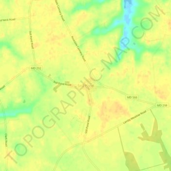
Name: Still Pond topographic map, elevation, terrain.
Location: Still Pond, Kent County, Maryland, 21667, United States (39.30787 -76.06532 39.34787 -76.02532)
Average elevation: 21 m
Minimum elevation: -3 m
Maximum elevation: 29 m
Other topographic maps
Click on a map to view its topography, its elevation and its terrain.