Geolocate

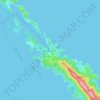
Grad Cres topographic map

Click on the map to display elevation.

About this map
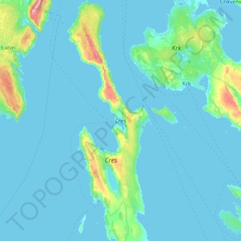
Name: Grad Cres topographic map, elevation, terrain.

Location: Grad Cres, Primorje-Gorski Kotar County, 51557, Croatia (44.74419 14.27247 45.17571 14.48654)

Average elevation: 62 m

Minimum elevation: -4 m

Maximum elevation: 804 m

Other topographic maps

Click on a map to view its topography, its elevation and its terrain.
Rijeka

Croatia > Primorje-Gorski Kotar County

Average elevation: 384 m

Rakovice

Croatia > Primorje-Gorski Kotar County > Soboli

Average elevation: 959 m

Tribalj

Croatia > Primorje-Gorski Kotar County

Average elevation: 226 m

Gomirje

Croatia > Primorje-Gorski Kotar County

Average elevation: 431 m

Punat

Croatia > Primorje-Gorski Kotar County

Average elevation: 94 m

Sunger

Croatia > Primorje-Gorski Kotar County

Average elevation: 887 m

Dolovo

Croatia > Primorje-Gorski Kotar County > Dolovo

Average elevation: 235 m

Brešca

Croatia > Primorje-Gorski Kotar County

Average elevation: 375 m

Liplje

Croatia > Primorje-Gorski Kotar County

Average elevation: 235 m

Dolovo

Croatia > Primorje-Gorski Kotar County > Dolovo

Average elevation: 235 m

Radovanj

Croatia > Primorje-Gorski Kotar County

Average elevation: 491 m

Selo

Croatia > Primorje-Gorski Kotar County

Average elevation: 868 m

Belo

Croatia > Primorje-Gorski Kotar County

Average elevation: 350 m

Turke

Croatia > Primorje-Gorski Kotar County

Average elevation: 507 m

Rova

Croatia > Primorje-Gorski Kotar County > Zidarići

Average elevation: 41 m

Gear up for your next adventure:

🦯Walking Poles - Supportive poles for long-distance walking
🧰Survival Kits - Emergency tools for remote environments
👖Convertible Hiking Trousers - Versatile zip-off pants for changing mountain weather conditions
Lightweight Tents - Compact tents for backpacking and trekking
🥼Base Layers - Thermal base layers for temperature regulation

As an Amazon Associate, this site earns from qualifying purchases at no extra cost to you.