
新鄉村 topographic map
Interactive map
Click on the map to display elevation.
About this map
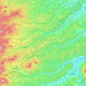
Name: 新鄉村 topographic map, elevation, terrain.
Location: 新鄉村, 三戶郡, 青森县, 日本 (40.40089 140.97875 40.49872 141.23838)
Average elevation: 217 m
Minimum elevation: 19 m
Maximum elevation: 708 m
Other topographic maps
Click on a map to view its topography, its elevation and its terrain.