
Hokuto topographic map
Interactive map
Click on the map to display elevation.
About this map
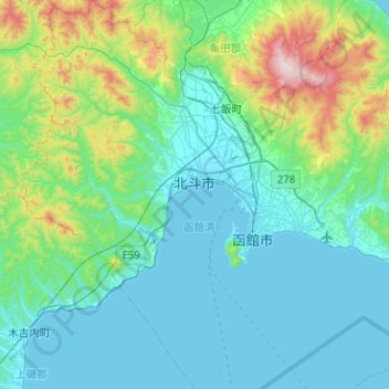
Name: Hokuto topographic map, elevation, terrain.
Location: Hokuto, 渡島総合振興局, Préfecture de Hokkaidō, Japon (41.62250 140.42745 41.99992 140.71958)
Average elevation: 186 m
Minimum elevation: 0 m
Maximum elevation: 1,169 m
Other topographic maps
Click on a map to view its topography, its elevation and its terrain.