
Juglas ezers topographic map
Interactive map
Click on the map to display elevation.
About this map
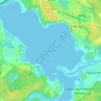
Name: Juglas ezers topographic map, elevation, terrain.
Location: Juglas ezers, Riga, Vidzeme, Latvia (56.96029 24.24717 56.99428 24.30589)
Average elevation: 5 m
Minimum elevation: -5 m
Maximum elevation: 21 m
Other topographic maps
Click on a map to view its topography, its elevation and its terrain.