
Quincy topographic map
Interactive map
Click on the map to display elevation.
About this map
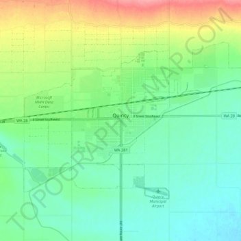
Name: Quincy topographic map, elevation, terrain.
Location: Quincy, Grant County, Washington, United States (47.20901 -119.89663 47.25637 -119.78948)
Average elevation: 400 m
Minimum elevation: 373 m
Maximum elevation: 458 m
Other topographic maps
Click on a map to view its topography, its elevation and its terrain.
Ephrata
United States > Washington > Grant County
The settlement of Ephrata is quite recent. There was no known settlement until 1886, just three years before Washington gained statehood. The horse rancher Frank Beezley was the first to settle near the natural springs, thus the area was known as Beezley Springs. As the climate and topography were not…
Average elevation: 434 m