
Kirchroth topographic map
Interactive map
Click on the map to display elevation.
About this map
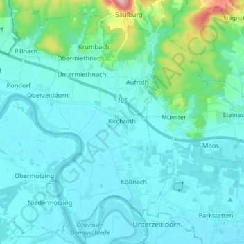
Name: Kirchroth topographic map, elevation, terrain.
Average elevation: 343 m
Minimum elevation: 314 m
Maximum elevation: 551 m
Other topographic maps
Click on a map to view its topography, its elevation and its terrain.
Konzell
Deutschland > Bayern > Landkreis Straubing-Bogen > Konzell
Konzell, Landkreis Straubing-Bogen, Bayern, 94357, Deutschland
Average elevation: 541 m