
Hopton Castle topographic map
Click on the map to display elevation.
About this map
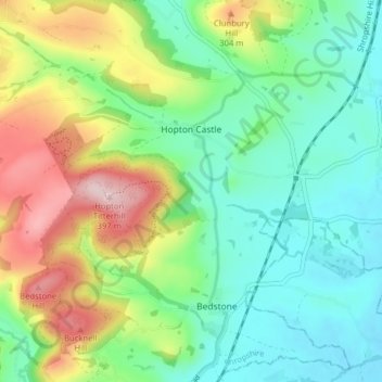
Name: Hopton Castle topographic map, elevation, terrain.
Location: Hopton Castle, Shropshire, England, United Kingdom (52.37234 -2.98435 52.40696 -2.90526)
Average elevation: 206 m
Minimum elevation: 119 m
Maximum elevation: 382 m
Shropshire trails, hiking, mountain biking, running and outdoor activities
Other topographic maps
Click on a map to view its topography, its elevation and its terrain.
Minton
United Kingdom > England > Shropshire > Church Stretton > Little Stretton
Average elevation: 272 m